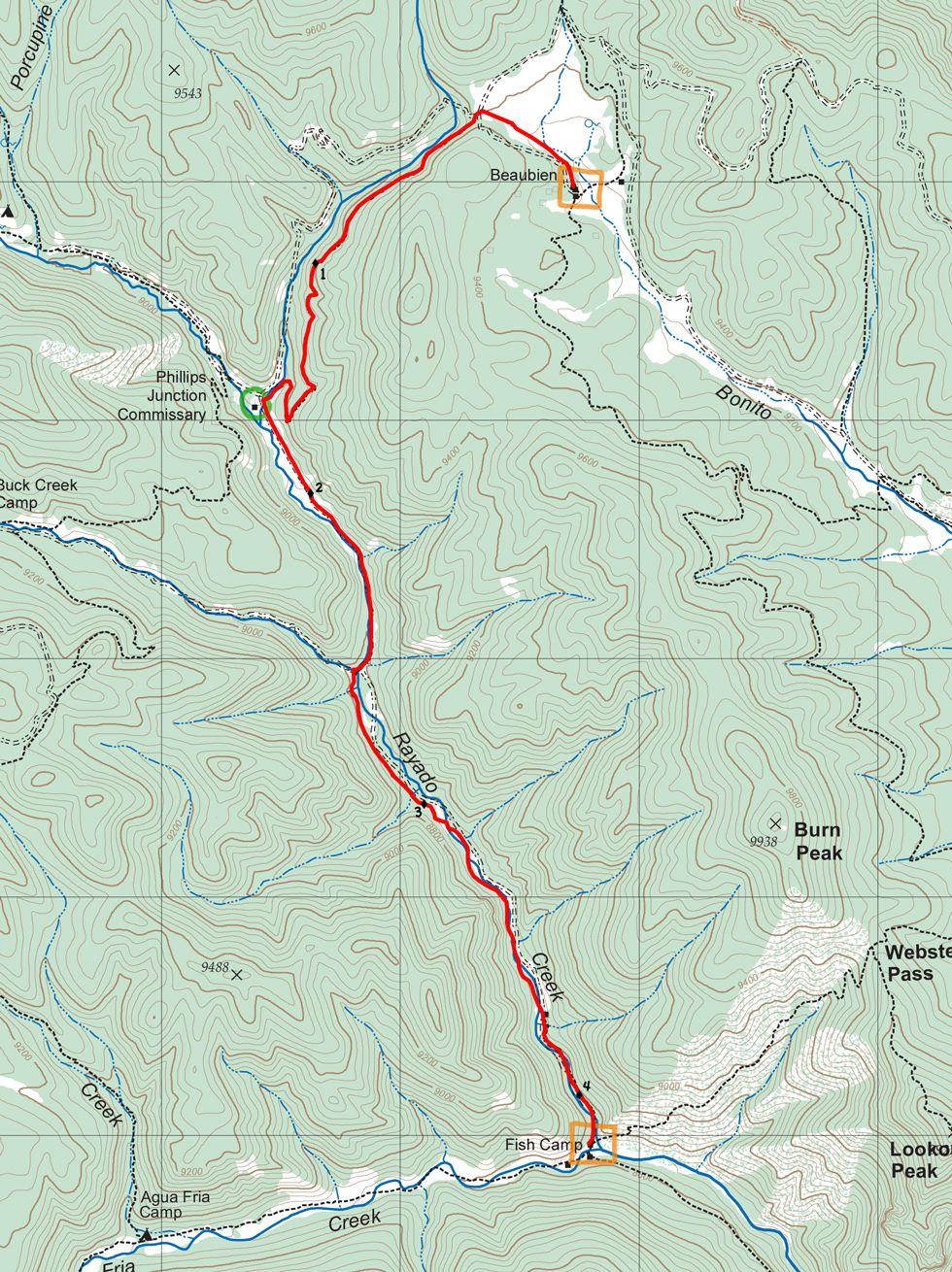

| Distance | 4.16 mi |
| Elevation Gain | 937 ft |
| Elevation Loss | 1,678 ft |
| Hiking Time | 2:32 |
| Starting Elevation | 9,337 ft |
| Ending Elevation | 8,596 ft |
| Min Elevation | 8,596 ft |
| Max Elevation | 9,422 ft |
A long, gentle descent from Beaubien to Fish Camp. For the first 1-1/2 miles, follow Apache Creek to Phillips Junction. Then bend to the southeast and follow Rayado Creek to the junction with Agua Fria Creek and Fish Camp.
Phillips Junction is a commissary. Showers may be available - fresh fruit usually is available.
Potable water is available at Beaubien, Phillips Junction, and Fish Camp. After the first 1/4-mile, you'll be walking along stream beds, so water is generally available to purify.
Itinerary 2 - day 9 (side hike)
Beaubien: staffed camp with Western lore, branding, horseback rides, chuck wagon dinner (some itineraries), and cowboy campfire. Showers.
Phillips Junction: commissary. Showers.
Fish Camp: staffed camp with cabin tour, fly tying, fishing.