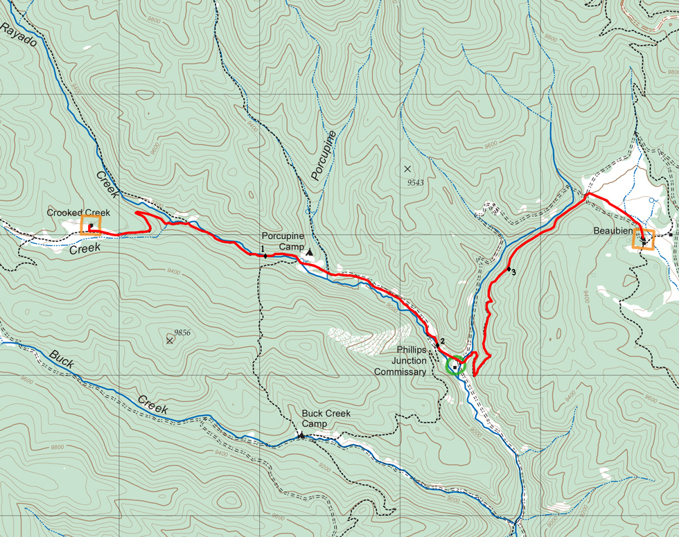

| Distance | 3.86 mi |
| Elevation Gain | 944 ft |
| Elevation Loss | 967 ft |
| Hiking Time | 2:07 |
| Starting Elevation | 9,360 ft |
| Ending Elevation | 9,337 ft |
| Min Elevation | 8,947 ft |
| Max Elevation | 9,429 ft |
From Crooked Creek, walk on a broad, gently sloping trail following Rayado Creek downhill to Phillips Junction. There are several roads and trails intersecting at Phillips Junction, so the trails can be confusing, but keep headed southeast until you hit the camp. From Phillips Junction, follow and equally gentle incline along Apache Creek to Beaubien.
Phillips Junction is a commissary, so you'll have a food pickup (depending on itinerary). Fresh fruit is usually available. Showers are available, but the pump is solar powered, so only after the sun clears the ridge (mid-morning).
Water is readily available along the route. Crooked Creek has a slow-flowing spring while Phillips Junction and Beaubien both have purified water. You hike along Rayado Creek for the first 2 miles. The next mile and a half is along Apache Creek which is not as easily accessible from the trail.
Itinerary 2 - day 8
Crooked Creek: staffed camp with homesteading.
Phillips Junction: commissary. Showers may be available.
Beaubien: staffed camp with Western lore, branding, horseback rides, chuck wagon dinner (some itineraries), and cowboy campfire. Showers may be available.